If you have ever stepped onto a Bluffview terrace and felt an instant shift—cooler air, filtered light, treetop views—you are not imagining it. This corner of 75209 sits on dramatic terrain shaped by Bachman Branch, and many homes are designed around that land. If you love design or you are considering a purchase here, understanding why ravine lots feel so distinctive will help you evaluate a property with confidence. In this guide, you will learn what creates that sensation, how architects respond to it, and the practical steps to take as a buyer or seller. Let’s dive in.
What sets Bluffview apart
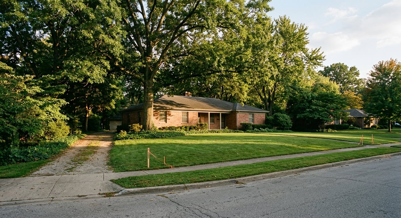
Bluffview grew from a 1920s dairy-farm subdivision that intentionally preserved its bluffs, creek corridors, and mature trees. Some cliffs along the neighborhood are commonly described as rising roughly 50 to 60 feet above Bachman Branch, which helps create sweeping views and privacy above the creek corridor. You can trace that preservation-first history through neighborhood archives and local preservation coverage about Bluffview Estates’ origins and character. Preservation Dallas documents the story and setting.
That topography—bluffs, winding creek, and canopy—shaped the neighborhood’s look and feel. Roads often curve with the land, not a grid. Many homes orient to views rather than the street, a pattern seen in both early and mid‑century design and in today’s custom builds. Recent local features have highlighted Bluffview’s evolution from pastureland to a pocket of luxury homes that still leverage its natural contours. For context on that arc, see this Dallas News neighborhood history and an architect’s perspective on designing to the terrain.
Ravine lot types in 75209
Bluffview’s distinct feel shows up differently depending on where a lot sits relative to the ravine and creek. Most properties fall into one of three positions.
Bluff-top lots
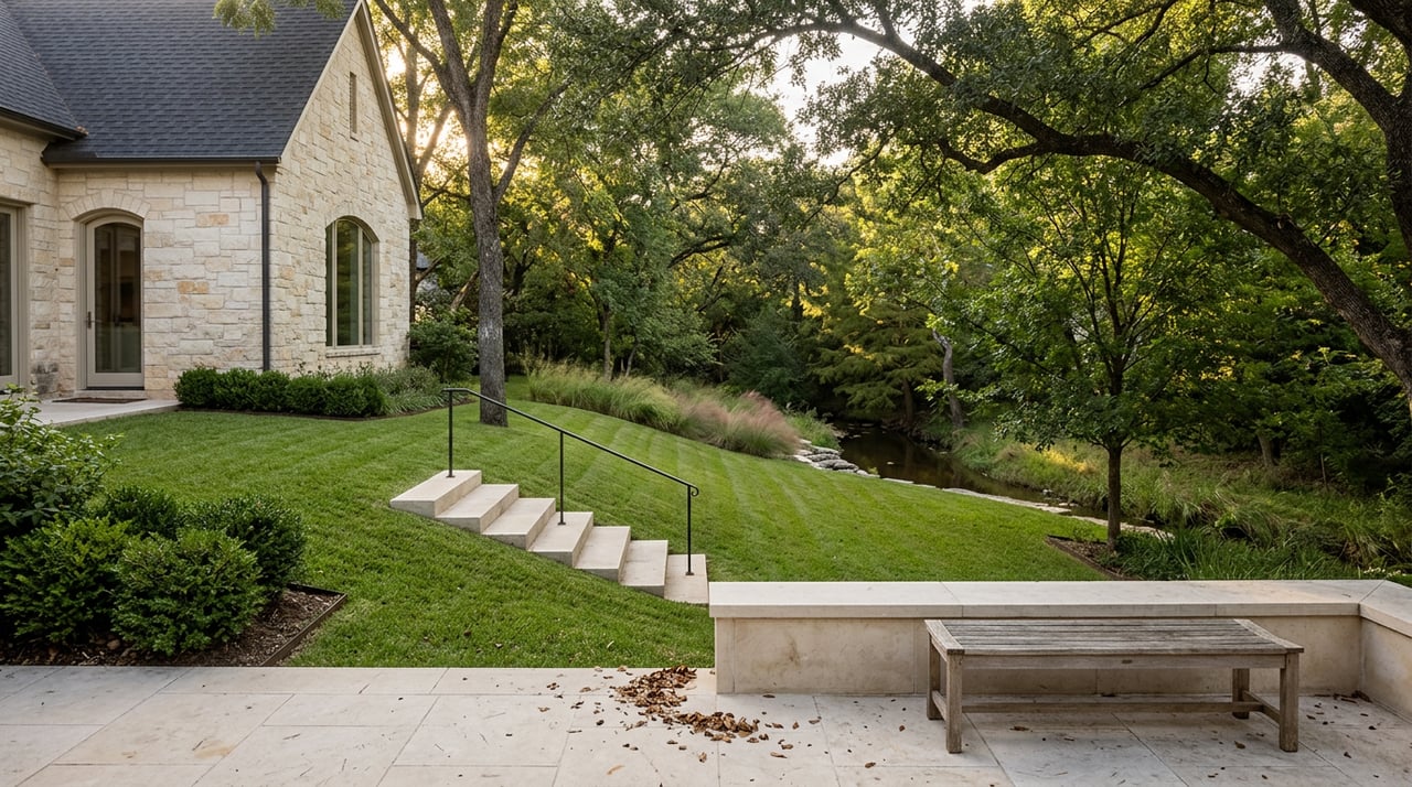
Bluff‑top parcels often have level areas at the street, then drop to dramatic views. These homes tend to emphasize back-facing rooms and terraces, creating an elevated, private vantage over the canopy and creek corridor. Neighborhood coverage often highlights how these sites balance street presence with quiet outdoor living behind the home. For a sense of how that evolved from the original subdivision to today’s builds, see this Dallas News overview.
Mid-slope lots
Mid‑slope homes are frequently terraced into the hillside. You might enter at street level, step down to living areas mid-slope, then out to lower patios or a walkout lawn. The result is layered outdoor rooms and strong connection to the site. It often requires thoughtful stairs, ramps, or driveway planning, which is why many architects treat these lots as a sequence of levels rather than forcing a single flat plane. Designers discuss this approach in features like this terrain‑focused design note.
Creek-edge lots
Parcels adjacent to Bachman Branch and the greenbelt feel the most “in nature.” They also bring constraints. Portions of the lower slope or immediate creek edge can fall within FEMA Special Flood Hazard Areas or be affected by drainage easements. Flood status is parcel‑specific, so always verify a property using FEMA’s Flood Map Service Center and review the recorded plat for easements or setbacks. Local reporting has tracked debates about how close development should occur near creeks, so written constraints on some lots are real and enforceable. For background on that regulatory context, see this Dallas Observer coverage.
Trees and the canopy effect
Bluffview’s mature trees are not an accident. Dallas recognizes its urban forest as a city asset, with documented comfort and economic benefits and active programs to preserve and expand canopy. You can learn more in the city’s forestry materials and Urban Forest Master Plan resources housed on Dallas City Hall’s forestry page.
In daily life, canopy means shade and cooling, layered privacy, and a softer acoustic environment. Peer‑reviewed research shows that dense vegetation can reduce perceived noise by several decibels depending on depth and geometry, which supports the common experience that creek‑lined lots feel quieter than nearby streets. A recent study summarizes those effects on sound. See this vegetation and sound analysis.
Tradeoffs come with the benefits. Mature trees shed leaves and seeds, roots can lift paving, and you may need arborist reports or tree‑protection plans before construction. Dallas’s forestry programs and local non‑profits provide frameworks for responsible tree care and permitting, so plan ahead and document what is protected if you aim to build or remodel.
How design adapts to the land
Architects in Bluffview have long treated the site as the design driver. That mindset shows up in a few recurring patterns:
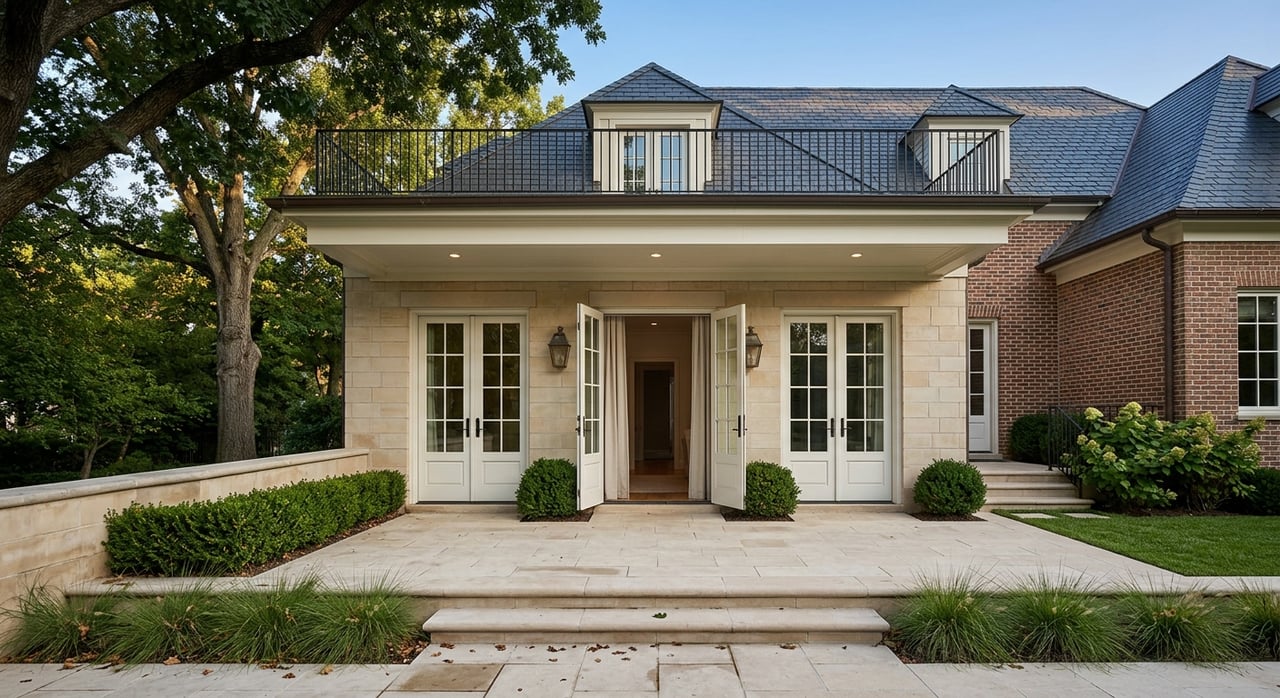
- Orientation to view: Principal rooms and glazing often face the ravine or a private courtyard rather than the street. Arrival sequences can be intentionally quiet from the curb, then open wide to treetops in back. See a designer’s take on this approach in this terrain‑aware design guide.
- Multi‑level plans: Split sections and half‑levels step with the slope, which reduces earthwork, preserves trees, and enhances indoor‑outdoor flow. Preservation groups also highlight this tradition in neighborhood write‑ups about how homes were tailored to the contours. Review the neighborhood’s character through Preservation Dallas.
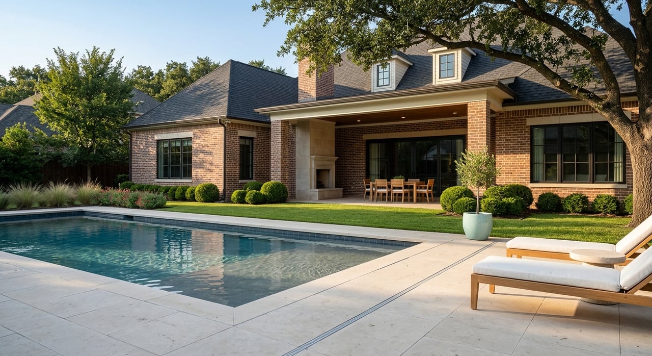
- Terraces and light touch: Cantilevered decks, tucked‑in patios, and small terraces let homes sit lightly on the land while maintaining view corridors.
That lineage runs from early and mid‑century names like Charles Dilbeck and O’Neil Ford to contemporary custom architecture. For a local historical lens on topography‑first design in Bluffview, see this piece highlighting Dilbeck’s work.
Costs, engineering, and permitting
Ravine lots are special, and they are also site‑specific. Expect more engineering and careful planning than on a flat, rectilinear parcel.
- Foundations and slope work: Common structural responses include drilled piers with grade beams, stepped foundations, helical piles, and retaining walls. Orders of magnitude for hillside foundations vary widely by design and soils, but industry overviews show that added foundation, retaining, and drainage scope can push costs from tens of thousands into low six figures on complex sites. For a plain‑English look at typical hillside systems and ranges, see this construction overview.
- Drainage and erosion control: Good site plans manage runoff with swales, terraces, native planting, and detention to keep water from undermining slopes or impacting neighbors. Recorded drainage easements and city stormwater rules apply and are enforced. For an example of how the city documents stormwater and drainage policy, review this City of Dallas memo and materials.
- Flood mapping and insurance: Flood risk is parcel‑specific. Creek‑adjacent properties may require flood insurance depending on FEMA mapping. Ask for current FEMA map printouts and any Elevation Certificate or LOMA/LOMR tied to the address. Start with FEMA’s map portal to confirm a lot’s status.
- Regulatory context: Dallas has long studied how development interacts with creeks, and local reporting has documented the back‑and‑forth over setbacks and allowable proximity. If your lot touches a drainage or creek easement, it will limit what and where you can build. For background, see this overview of creek‑adjacent development issues.
Buyer and seller checklists
If you are evaluating a Bluffview ravine lot, request documentation early. It saves time and reduces surprises during option periods.
Documents to request or verify:
- Current plat with all recorded easements called out, including drainage or watercourse easements and utility easements.
- FEMA Flood Map excerpt for the parcel and any Elevation Certificate or LOMA/LOMR.
- Topographic survey with contours, not just a boundary survey, to understand slope and buildable areas.
- Tree survey or arborist report and any city tree‑permit history.
- Geotechnical (soils) report if construction is planned or if major additions are contemplated.
- Any history of flood or storm claims, permits for retaining walls, and past grading or drainage plans.
Key questions to ask the listing agent:
- Is any portion of the lot inside a FEMA Special Flood Hazard Area? Are there prior flood‑insurance claims?
- Are there recorded drainage easements or creek setbacks on the plat? Do they affect buildable area?
- Is there a recent tree inventory or an approved tree‑protection plan? Which specimen trees are protected?
- Has a geotechnical report ever been prepared for this site, and is it available for review?
Why these lots feel distinctive
Put simply, the land does the work. Elevated bluffs and incised ravines frame long, layered views. A mature canopy filters light and softens sound. Homes tend to turn inward to courtyards and outward to the treetops, creating a choreography of indoor and outdoor rooms that feels private and calm.
You trade some simplicity for that drama. Expect more due diligence, possible flood considerations near the creek, and higher site‑work costs compared with a flat city lot. For many Bluffview owners, the result is worth it: treetop privacy, sun‑dappled terraces, and architecture that follows the land.
Work with a local guide
Bluffview’s most compelling properties reward careful preparation. A senior‑led team that understands Dallas construction, permitting, and neighborhood character can help you gather the right documents, interpret constraints, and position a sale or purchase with confidence. With more than $300M transacted and 50+ combined years in Dallas neighborhoods, The Ryan Group brings high‑touch guidance and Compass‑powered marketing to premium single‑family homes, townhomes, and select land. Schedule a free consultation, and let’s tailor a plan for your Bluffview goals.
FAQs
What defines a ravine lot in Bluffview, Dallas 75209?
- A ravine lot sits on or near the bluffs and slopes carved by Bachman Branch, creating elevation changes, irregular lot shapes, and layered views that differ from flat city parcels.
Are creek-edge homes in Bluffview always in a flood zone?
- No. Flood status is parcel‑specific; some lower slopes and creek edges fall in FEMA Special Flood Hazard Areas while bluff‑top portions can be outside them. Always verify using FEMA maps and property documents.
Do Bluffview ravine lots cost more to build on?
- Often yes. Slope‑responsive foundations, retaining, drainage, and tree protection can add meaningful cost compared with flat lots; ranges vary by soils and design and should be confirmed with local engineers.
How do trees affect privacy and noise on these lots?
- Mature canopy increases visual screening, provides shade, and can reduce perceived noise by several decibels in dense plantings, which contributes to the calm, tucked‑away feel many buyers notice.
What documents should I request before offering on a Bluffview ravine property?
- Ask for the recorded plat with easements, a FEMA Flood Map excerpt and any Elevation Certificate or LOMA/LOMR, a topographic survey with contours, a tree survey or arborist report, any geotechnical report, and records of prior drainage or retaining‑wall permits.